Test post 1614
ANyone reading this?
– escape domestication

ANyone reading this?
Yes or No
Paid the boatyard bill for s/v Ferrity today. Ouch!
See a lot of beans and rice in the future. Fortunately Amazon is there for my other nutritional need.🥃🥃
Found a moonshine still on Amazon.

Beta Marine 43 fired up for first time.
Water stirrer works.⛵️⛵️⛵️⛵️
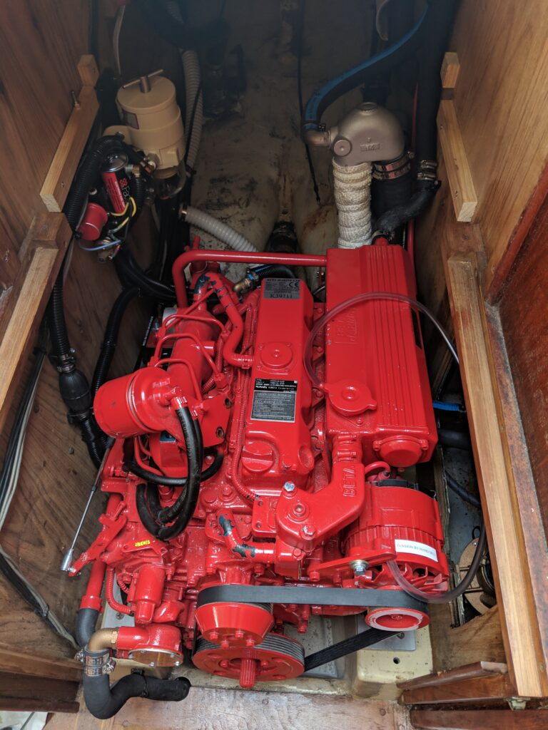

New engine running.
New chainplates ready to install. Three types are required for Ferrity’s six shrouds. I removed three old ones and sent to Garhauer Marine so that they could manufacture duplicates. (In the photo, the “smudge” across chainplates is reflection of boom canvas. Less shiny ones are the samples.)
The old ones, including fasteners looked fine albeit 30 years old. But after the work involved in removing, I opted to replace. Highly recommend Garhauer, easy to work with and quick turnaround. BTW, all of my blocks are by Garhauer.
For non-sailors, the chainplates bolt to the hull. A stainless steel cable then runs from the top of the chainplate to various points on the mast. Most important goal for a sailboat is to keep the mast vertical and preferably pointing skyward.⛵️⛵️
